Skyline Application-load wms layer
1. Release mxd project
Publish mxd with arcgis server. When publishing, check "Support WMS service and WFS service";
2. TE loading wms
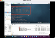
Load the image layer on the layer toolbar, select Load WMS layer, set the address of WMS service, a list of WMS layers that can be loaded will appear, set the corresponding attributes, select png format for the image format, and do not modify the others. When a warning prompt pops up, confirm to continue the operation;

3. Image layer attribute settings
Set the transparency attribute of the layer and remove the unnecessary places. The detailed settings are as follows:
Set the stacking order of layers. The higher the order, the higher the stacking order

4. Ordinary layer processing
For commonly used place names and location layers, if the style is not complex, you can load them by loading WFS;
5. Layer clicking function realization
For image layers loaded on TE, click on TE to obtain the current coordinate point, transfer the coordinate point to arcgis server, determine which element is clicked, return the response to TE, and be able to return the attributes of the element. For details, please find the relevant development api of arcgis server.